Subscriber question:
"Under VFR, my altimeter displays one altitude while my GPS displays a different altitude. Which one do I use?" - Wayne P.
John:
“Under VFR, you should be flying at a cardinal altitude (odd or even thousand-foot altitudes e.g. 4,000, 5,000, 6,000, 7,000, etc.) plus 500 feet. This provides separation from IFR aircraft and other VFR aircraft on crossing courses.
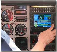 Your altimeter displays indicated altitude and this is what you should always use (for traffic separation). Indicated altitude is pressure altitude corrected for local atmospheric conditions. The correction is done by entering the altimeter setting given by Air Traffic Control or on an AWOS.
All aircraft in a given area should be on the same altimeter setting so relative (altitude) separation is maintained.
A GPS, on the other hand, measures your absolute altitude off several satellites. While more accurate than pressure altitude, it does not provide the same relative separation from other aircraft (since all aircraft are using indicated altitude).”